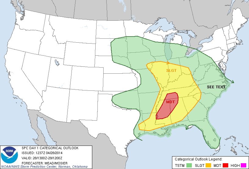
That morning everything seemed to be coming together nicely for a few supercells that could produce tornadoes, with a peak to visible satellite in that area, skies seemed to be clearing and destabilizing nicely After reviewing a few things we set our target to Macomb, Ill. When we hit the road the temps were in the high 40s in southern Wisconsin, as we made our way to the Quad cities and south on I-74 the temperature slowly began to rise and skies were clearing. When we finally crossed the warm front the temp shot up to near 75F and the dewpoints into the low 60s. After looking at radar and satellite for a bit, it looked like the arc of cumulus would ignite storms in Iowa across the river, with very limited river crossings we did not want to take that risk so we decided to play it out in hopes storms would fire on our side of the river. After watching several towers trying to go up and not surviving long, one to our southwest seemed to stay pretty persistent and was now showing some decent amounts of lightning on radar so we decided to give this cell a shot. We met with this cell on a rural highway west of Macomb and was surprised at the constant rumble of thunder it had with it, while trying to get into a better position to view, we chose a road that was, well absolutely terrible! (see video)
After quickly making our way back to the main road we caught back up with this cell that had one of the weirdest yellow looking cores I have ever seen along with some beautiful intercloud lightning.
While watching this in amazement for awhile, the storm started to slowly drift off to our north so we had to reposition and quickly catch back up to it on rural gravel roads. After catching back up to the storm it seemed to be taking on supercell type characteristics and looked like it was developing a wall cloud with a classic clear slot punching in from the right side.
After several minutes of trying to organize into a nice supercell, the storm was quickly merging with other storms and becoming more outflow type storms with bowing segments, a sign that the threat for tornadoes was quickly reducing. We decided to abandon this cell after awhile and position ourselves in front of a little bowing segment that looked very beefy on radar. After finding a gravel road with a great view the storm was coming into view on the horizon and a beautiful shelf was emerging.
The green core and beautiful structure made for a few beautiful pictures. After getting back ahead of this cell on the highway it was rotating like a top on the leading edge right behind us but would never quite survive the battle with crossing the boundary into stable air. We soon decided to call it a day and head north towards home where we enjoyed a great lightning display to keep us entertained for awhile. Although no tornadoes this tie, we did have several laughs and see some great stuff. Until next time, thank you for coming along for the journey :)
Like us on Facebook: https://www.facebook.com/WisconsinWeatherPhotography


No comments:
Post a Comment