Thursday, March 2, 2017

Out Like A Lion.


For most of us in the upper Midwest, the end of February is usually riddled with snow storms and lingering winter cold.
February 28th, 2017 was anything but a typical Winter day.

I never truly intended to chase on this day, to be honest the best threat for tornadoes looked to be way south and I was fighting a cold and fever that just made for a miserable time.
After a late night/early morning review of weather models though, it became apparent we needed to chase in northern Illinois.
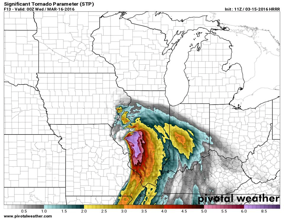
A few things that stuck out were a boundary would lay across the region and the Energy Helicity was pretty much maxed out, as well as models showing a rotating supercell across the area that afternoon.


Earlier on Tuesday morning I awoke to severe thunderstorms across southern Wisconsin, something that has not happened since 1999. These storms contained some very large hail, just a prelude of the strength of this system.


Soon after the new severe weather forecast from the Storm Prediction Center came out and tornado probabilities were raised a bit north and everything seemed to be coming together nicely for a severe weather outbreak.


Jason and I met up and got on the road about 1:00pm with a target of Mendota Illinois, the line of thinking was it was between I-88 and I-80 and that seemed to be the best possible place to set up in the middle.
After being on the road for about an hour a mesoscale discussion and associated tornado watch was issued for our area.


We arrived in Mendota and got fuel and waited around for storms to initiate.
About an hour later a storm in Iowa to our NW went warned and looked to be a line of supercells behind it pegged to move across I-88.
At the same time storms had fired to the southwest of us as well so now we were faced with a grueling decision, go north to warned storms or drop south for forming storms.


The storms to the south looked a little ragged and linear at the time, while a storm to the north went tornado warned and every cell behind it had the same "tornadic signature" look to it, so the decision was made to make the dash back north to highway 30 and then head west to storms.
The drive seemed like it took forever once we got on highway 30, but our storm ha maintained its tornado warning and we were on a dead approach to it.
after getting west a ways the sky had cleared enough for us to see the cumulus tower and sun peaking out, a truly beautiful sight to see in itself!


We continued the journey west and a quick peak at radar revealed storms to the south had very dangerous looks to them and we knew we may regret going north.
At this point there was no turning back now though as our storm had just been tornado warned again and 2 areas of distinct rotation headed directly for us.
We turned north on a side road just outside Sterling, Illinois to see some beautiful supercell structure crossing the road ahead of us along I-88.


We followed this feature for a ways down the road and saw a few suspicious areas but never could confirm a tornado although an EF-1 rated tornado was confirmed in the area.
After realizing the day was over we stopped to watch the shelf move away and met up with a fellow chaser from Wisconsin, Dan Rupnow who had also chose to come north.
After talking for about 30 minutes we all decided it was time to call it a day.

The trip home was a short drive, but there we were, in February out chasing again.
Unfortunately a few lives were lost in this storm system as well as a many homes damaged and destroyed, our thoughts and prayers are with them.

Be sure to follow me on Twitter/Instagram  @TomPurdyWI
or on facebook at @WisconsinWeatherPhotography

Tuesday, August 2, 2016

Earlville, Illinois Rain Wrapped Hell 6-22-2016

June 22nd, 2016 was a tricky chase day, characterized by a surging warm from with dewpoints into mid 70s and bulk shear running 50-70kts.
The concensus was a few initial supercells, possibly tornadic, and then a quick upscale growth into a fast moving linear mess.

 
Our Intital target that day was the Dixon, Illinois area, a decent river crossing was available and a good any direction road network was available.
We decided to avoid the interstate since contruction season was in full swing in Illinois and took the country road routes where it became quite apparent of the spin in the atmosphere as seen by this and many other horseshoe vortexes.
 
 
We arrived in the Dixon area a little before 5:30pm where a tornado watch was issued for the area with the mention of a few intense tornadoes possible.
 
As seemed to happen an awful lot this year storms would fire and pulse for quite some time.
This seemed to be no different and began to question if storms would merge to fast as multiple cells fired at once along the boundary and congealed quickly.
What happened next is probably one of the 1st times I have experienced multiple cell splits and storms going from linear in nature to supercellular.
We did though have to get south and east as storms were approaching us quickly and still sub-severe.
A beautiful discrete cell was taking shape near Sublette and moving directly at us while in the mean time a storm to our north in the rain was beginning to rotate and take better shape...a decision had to be made on play the disorganized cell or go into the rain after the established cell...naturally we chose to play in the rain. :/
 
By this time the cell to the north was tornado warned and we made our move to get in position, as we approached the cell, the lightning striking the ground in and around it was super intense like I have never seen before, constant strike after strike as seen in this video compilation.


After maneuvering through some heavy rain and wind we found a spot south of Paw Paw which looked like would bring the track of the circulation just to our east, what we didn't anticipate was a south lunge right at us on the circulation so we had to bail back southwest to get in a safer position.
We found ourselves just outside Earlville, Illinois and had a good position to see the tornado if it was in there, unfortunately Earlville looked to be right in the path.


We saw what was most likely the meso through the rain with little circulations dancing around the outer edge of the parent circulation but could not confirm an actual tornado on the ground, we continued east with the circulation through Earlville where some significant damage was apparent but mainly outbuildings and trees, luckily minimal damage to residential buildings.
Eventually east of town the daylight would fade and the option to abandon the storm as it had weakened and very rain wrapped was taken.
We passed back through town to see if any help was needed and proceeded our trip home.
Some of the damage can be seen in the video below.


The tornado that was in there went on to be rated an EF-1 but did minimal damage. The tornado track was within a mile or so of our location but heavy rain obscured us from confirming ever actually seeing a tornado, but we know it was there. A testament to the dangers of low light, rain wrapped tornadoes.


 Below is a link to the video where a tornado is hidden just outside Earlville.
Thank you for stopping by and be sure to follow us on Facebook!


Thursday, March 17, 2016

Good Hope Redemption March 15th, 2016

December 23rd 2015: A late season Christmas Chase in West Central Illinois brought us through Good Hope, Illinois where we missed a tornado by mere minutes just outside of town, a rather disappointing and dejecting end to 2015.

March 15th 2016: An early Spring system was setting up again in the upper Midwest, the question would be where? Models indicated west central Illinois again as the potential target with deepening Low Pressure and some pretty good early season dynamics. The biggest question remained would be how much moisture was available.


Waking up Tuesday morning the day was starting to look like it could be a potentially big day, high resolution models painted a pretty good scenario for tornadic supercells and we agreed on our initial target of Macomb, Illinois. Home of Western Illinois University.


I decided to drive up to Jasons house in Edgerton around 9:30 Tuesday morning so we could set the car up and go over models, as well as wait for the 11:30 SPC update to read their thoughts on the rest of the day. When the update did come out were were happy to see our target area was now in an enhanced risk for severe thunderstorms along with a 10% tornado threat.


We left Edgerton around 11:45 fueled up and hit the road en route to Macomb. We arrived in Macomb a little after 2:00 and found a burger king parking lot to sit and wait in. While there an MD was posted by the SPC for a likely tornado watch with a tornado watch that soon followed with very surprising probabilities.


After sitting awhile the 1st few blips on the radar began to form and quickly strengthen...game on!
After watching these storms from a good distance we began to see a nice supercell take shape near Bentley, Illinois but was very disorganized at the moment. We continued to watch as this storm grew closer and closer.


After continuing to watch this storm develop for awhile storms behind it were being tornado warned and we at one point considered bailing on this storm and heading west, a decision we are glad we didn't make.
We stuck with the storm awhile and started getting dumped on with hail that was mainly dime and quarter size and decided we needed to get a little south into better position. While heading south next to the storm I made the remark "it looked very outflowish and crappy" something that would change rapidly in just 5 minutes. While stopping to get a quick look at what was going on right outside Good Hope we realized the storm was starting to wrap up and rotate heading right at us. We began bailing south while the storm began to wrap up tighter, soon after we saw the tell tale dust swirls in the field right next to us literally 100 yards away heading right at us, TORNADO! 


This storm was not warned at the time so we made a quick phone call and got safely south and turned around to see the tornado cross the road right behind us along with a beautifully rotating meso/wall cloud.


We snapped some pictures and videos of the storm and the proceeded to follow the storm for several miles watching it kick up dust/dirt and a little debris intermittently. We lost the storm around St Augustine after being stuck behind emergency crews and getting hit hard with RFD.
After we got out of that mess we continued on towards Peoria where another storm was just going tornado warned where we battled wind blown hail and may have briefly caught a glimpse in the lightning flashes.


After losing sight of this feature we had lightning bolt after lightning bolt hitting all around us so we decided to stop and attempt some lightning pictures before making the 3 hour trek back north towards home.


This was the perfect end to a great day as we make the drive pack to Wisconsin. We arrived in Edgerton around midnight exhausted but excited for what had just happened that day.
The Good Hope tornado was officially rated an EF-2 tornado with a max with of 1800 yards (over 1 mile wide.  Below is a timelapse video of the meso/wall cloud.
Hope you all enjoyed and be sure to like us on facebook! www.facebook.com/WisconsinWeatherPhotography


Full Good Hope, Illinois wall cloud/tornado sequence time-lapse from my dash cam yesterday. It is hard to see the tornado, but the dust whirls are there.
Posted by Tom Purdy on Wednesday, March 16, 2016


Thursday, December 24, 2015

Christmas Chase with the FIBs

Wednesday December 23rd was destined to be a chase day for about a week prior, the only question would be where. The initial thought was the mid south would be the only place to be. A few days prior a secondary threat started to materialize in central Illinois as deepening low pressure was forecasted to bring mild temps and spring like moisture to this part of the country.  The day prior the decision was made to stay in Illinois and target near the low pressure. Most models indicated decent cape and shear as well as showing a few rotating supercells developing in north central Illinois.
 
Wednesday morning we awoke to a slight risk of severe weather all the way into southern Wisconsin and a very evident, albeit small tornado risk in western and central Illinois.
 
I left my house in Janesville at around 8:30am to meet Alec Scholten in Rockton. On the way to Alec's house it was quite foggy, cool and began to rain. I remember thinking to myself "How is this even a chase day" We left Alec's house to snag up Brett Wright and began our trip to La Salle where we would meet up at Dennys with Adam Lucio and Danny Neal. 

After grabbing a bite to eat and looking over the day ahead, we decided to play west central Illinois.
The mood was rather festive to say the least and you could feel the excitement in the air as the sun decided to make an appearance for the 1st time of the day. While sitting and talking about past chases the Christmas music was loudly playing over the loud speakers at the truck stop we awaited at and then the music was broke by a familiar sound of cell phones going off alerting us a tornado watch was being issued for our area. (Christmas Music and weather radios) Never thought I would be able to say that together but chase on!
 
We set out to our southwest as a line of supercells started to rapidly develop in eastern Iowa and Northeast Missouri. How far west we wanted to go was the question, we ran a bit of disagreement to this as I though we would get to far west to have any good position as I thought storm motions would be a little bit faster than they were. After a brief discussion it was decided to continue west/southwest and try and get into position before dark.
 
We proceeded to drive south on Highway 67 towards Macomb when we started to get our 1st glimpse at the low topped cumulus towers and clear view of several bases from our location. During this time storms would start to take on quickly changing characteristics from looking good to looking kind of cruddy with no dominant storm making it's presence known quite yet. After continuing to drive south we decided to stop in the town of Roseville for gas and reevaluate our situation. After getting fuel we decided the southernmost storm was the dominant storm. (A decision we would soon regret)
 
 
As we continued south towards Macomb a train would block our highway and we decided to take an alternate route east and then back south as to not lose our chance at our storm. When we finally got back into position for our storm we got our 1st view at its base and updraft. It wasn't bad looking but not the greatest either but there was several intense lightning bolts shooting out in front of it that gave it the impression it was rapidly intensifying. We stopped along a country road for a few minutes to watch the storm approach when our phones once again alerted all of us to a tornado warning with a confirmed tornado just back to our north (Rememeber the train tracks) so we quickly spun around and headed back north to get to the storm.  As we punched through the core of our storm we encountered some heavy rains and gusty winds before coming out to a clearing on the other side and having a visual on the tornado warned storm, which was nothing more than a weak little updraft with almost no precipitation. We continued to follow this storm for a few miles while going through small towns with tornado sirens blaring and Christmas decorations hung all over the place, a very confusing sight.

On the tornado warned cell near Macomb
Posted by Danny Neal on Wednesday, December 23, 2015
Soon after the storm had dissipated and we were left with a line of dying storms that had one more great surprise in store for us. As the sun began to set the updrafts directly over our heads began to light up an amazing pinkish/orange color and started developing some awesome mammatus, something I always enjoy seeing!


After taking several pictures out the car window the sun would soon be set and our chase day was over, or so we thought.
As we traveled back north to get back to the highway home a small lightning-less updraft quickly formed and went tornado warned. After watching this for several minutes nothing would come of it and the warning was soon canceled.

Soon after this we would learn we missed a small rope tornado back near Roseville and then would learn of a violent tornado in the Mississippi & Tennessee area. Feeling a little dejected we began our trip home, but it occurred to me on the way home that we got to chase in late December less than 4 hours from home and got to see some beautiful things along the way as well as many many laughs!

Thank you to Alec, Adam, Brett, & Danny for a fun filled day!

Please be sure to like my page at https://www.facebook.com/WisconsinWeatherPhotography
Also be sure to check out my friends pages here for great weather info, photographs and more!

Adam Lucio and Danny Neal: https://www.facebook.com/illinoisstormchasersllc

Brett Wright: https://www.facebook.com/TornadoTitans

Alec Scholten: ( You can also book storm chasing tours through him) https://www.facebook.com/TwistedSkyTours

Sunday, December 6, 2015

April 9th, 2015 The day that I wasn't ready for.


Like so many storm chasers I look forward to the chase days, the wording of "A few strong tornadoes possible" this is what I love to do, this is my passion. Also like so many others I knew a time would come when I would see things that I didn't want to see.
The morning of April 9th was no different than any other chase other than the fact that our target was within 50 miles from home, virtually in our back yard. As a chaser you are excited, as a resident of the area you have a few extra nerves going.
When we left Janesville that early afternoon we knew there was a chance of seeing a tornado or 2, never did I imagine we were a few hours away from seeing the most violent tornado of 2015 in the U.S. The conditions were coming together very nicely! As the day progressed I began to wonder if we would see any good storms as they kept dying from being choked off all instability. As it would happen a storm would form about an hour before daylight would fade into the early Spring air and darkness would set upon us. Driving through large hail shortly after was the highlight of my day at the moment, the sound of baseball sized chunks of ice thumping against the roof of the car was music to my ears.
When the tornado warning was broadcast with the words "large and dangerous & particularly dangerous situation" your heart skips a few beats. I remember the sight of this monster and watching it spin and rip trees and earth up and being excited about this.
Soon we would drive through a few small communities, always wondering if it was in the path of this monster and was our chase over to start search and rescue. Fortunately none of the small towns were touched to that point.
We had pulled over to watch the tornado, still large, fade into the darkness. An eery roar was all you could hear, followed by sirens from emergency crews responding to anyone that did need aid.
While stopped along the road all I could smell was this distinct smell of earth, like you had just been working in your garden all day.
As we sat and watched the tornado disappear, residents had begun emerging from their homes and driving around the area checking on friends and loved ones. As we sat there trying to come down from the high of what we had just seen, a couple teenagers pulled up in a truck very excited as the tornado had come within a 1/4 mile of their home. As we talked a little one of them looked at the lot about 200 yards across the field and said "Hey that was so and so house" Looking over my heart immediately sunk deep into my stomach, what was once a house was simply reduced to a concrete slab. I remember calling my dad and being able to emotionally muster up the phrase "If anyone was in that house they are dead" Fortunately we later learned they were not home at the time.
The short drive home was quiet for the most part as we learned of severe damage and at least 1 death in Fairdale. The next morning I returned to the area for a few interviews and was just in awe of the damage. Less than 24 hours before this was a quiet little bedroom community that was now literally wiped off the map. While I was there a press conference was being conducted to announce a second confirmed fatality, something I always dreaded hearing or seeing.
When I left that afternoon I felt sick, how could something I love so much hurt so many people and me be ok with it? I took the long way home that afternoon and realized just how important life really is and how quick it can change.
In the weeks following I made a few return trips to volunteer and had the opportunity to meet people affected and hear their stores of that evening, more importantly I was treated like I belonged there, they welcomed me with open arms and offered me pie and coffee and donuts, etc. Some even found ways to joke about how they got closer than I was or how they got better video.
I knew storm chasing that I would eventually see some pretty big damage, never did I think I would see something so violent do so much horrific damage and never did I think I would be so mentally unprepared when the time came.
To the people of northern Illinois, first responders, meteorologists, volunteers....You are all amazing people and did one amazing job that night!

Friday, June 26, 2015

Coal City Tornado: A Survivors Story

Courtesy of Shawn McLey


Coal City, Illinois is a small community of about 5,500 people that sits about 60 miles south of Chicago in Will and Grundy counties. A town that is not unfamiliar with tornadoes, on November 17th 2013 an EF-2 tornado ripped through part of town leaving many residents to rebuild.

Monday June 22nd started out as a normal day for Shawn McLey, his wife, and their 3 dogs. A summer rainstorm had came through the area that morning followed by a few peaks of sunshine and clouds. A chance of severe thunderstorms was in the forecast later that afternoon. Shawn and his wife went about their day, little did they know 90 miles away a storm would form that would change their lives forever. Around 3:30 pm a tornado watch was issued for most of north central and northwest Illinois. Around 7:00 pm a tornadic thunderstorm was taking shape Near Amboy, Illinois some 90 miles away and heading towards the small town of Coal City.
Meanwhile storm chaser Adam Lucio had already documented a couple tornadoes from this storm and was traveling along Interstate 80 trying to keep up with the storm. "I thought I was gonna die when the storm crossed over me on I-80" Lucio said. "I have never seen whiteout rain like that before, that thing was a monster"
At 9:06 pm a tornado warning was issued for Grundy county Illinois. As this tornadic storm was bearing down on the area, Shawn stated "I heard the sirens go off once" Around 9:30pm "The sirens went off a second time and my phone went off and we had about 3 minutes to take cover" I asked Shawn if he owned a weather radio to which he stated he did not. "We didn't have time to get into our crawl space, we just ran into the bathroom and huddled down. I can't get the sound of stuff hitting our house out of my head, the sound and the pressure was so intense" The tornado had now passed and Shawn, his wife and 3 dogs had all survived the tornado. A night they will not soon forget.
Reflecting back to that night and everything that had happened Shawn emotionally stated "People need to realize that when a warning is issued you better take it seriously because I could have been one of the people that died that night".

In closing what was a tragic day could have been much worse. 0 deaths were reported from 9 confirmed tornadoes across northern Illinois, a reflection of the amazing job the National Weather Service in Chicago truly does. People of northern Illinois are dealing with a lot this year, but they should also all be proud of the resilience they have shown this year.
A big thank you to Storm Chaser Adam Lucio and Shawn McLey for agreeing to do this with me.
This story is a true testament of how invaluable weather radios really are and maybe it is time as a community to require them in every home.

Be sure to check out Adam Lucio's page and the NWS Chicago for more great weather information!
 Be sure to Check out my page also