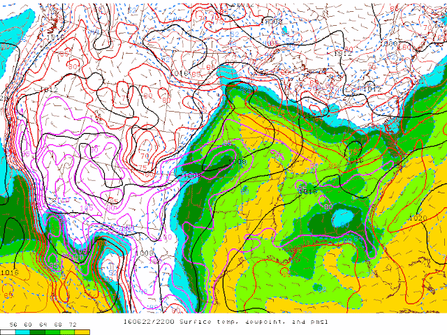
The concensus was a few initial supercells, possibly tornadic, and then a quick upscale growth into a fast moving linear mess.
Our Intital target that day was the Dixon, Illinois area, a decent river crossing was available and a good any direction road network was available.
We decided to avoid the interstate since contruction season was in full swing in Illinois and took the country road routes where it became quite apparent of the spin in the atmosphere as seen by this and many other horseshoe vortexes.
We arrived in the Dixon area a little before 5:30pm where a tornado watch was issued for the area with the mention of a few intense tornadoes possible.
As seemed to happen an awful lot this year storms would fire and pulse for quite some time.
This seemed to be no different and began to question if storms would merge to fast as multiple cells fired at once along the boundary and congealed quickly.
What happened next is probably one of the 1st times I have experienced multiple cell splits and storms going from linear in nature to supercellular.
We did though have to get south and east as storms were approaching us quickly and still sub-severe.
A beautiful discrete cell was taking shape near Sublette and moving directly at us while in the mean time a storm to our north in the rain was beginning to rotate and take better shape...a decision had to be made on play the disorganized cell or go into the rain after the established cell...naturally we chose to play in the rain. :/
By this time the cell to the north was tornado warned and we made our move to get in position, as we approached the cell, the lightning striking the ground in and around it was super intense like I have never seen before, constant strike after strike as seen in this video compilation.
After maneuvering through some heavy rain and wind we found a spot south of Paw Paw which looked like would bring the track of the circulation just to our east, what we didn't anticipate was a south lunge right at us on the circulation so we had to bail back southwest to get in a safer position.
We found ourselves just outside Earlville, Illinois and had a good position to see the tornado if it was in there, unfortunately Earlville looked to be right in the path.
We saw what was most likely the meso through the rain with little circulations dancing around the outer edge of the parent circulation but could not confirm an actual tornado on the ground, we continued east with the circulation through Earlville where some significant damage was apparent but mainly outbuildings and trees, luckily minimal damage to residential buildings.
Eventually east of town the daylight would fade and the option to abandon the storm as it had weakened and very rain wrapped was taken.
We passed back through town to see if any help was needed and proceeded our trip home.
Some of the damage can be seen in the video below.
The tornado that was in there went on to be rated an EF-1 but did minimal damage. The tornado track was within a mile or so of our location but heavy rain obscured us from confirming ever actually seeing a tornado, but we know it was there. A testament to the dangers of low light, rain wrapped tornadoes.
Below is a link to the video where a tornado is hidden just outside Earlville.
Thank you for stopping by and be sure to follow us on Facebook!


